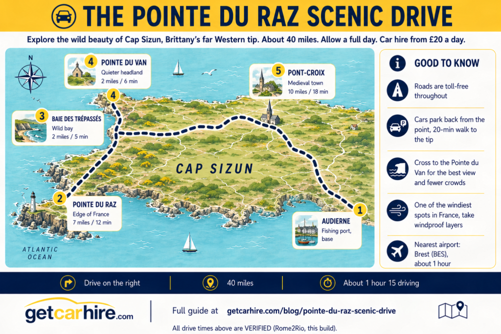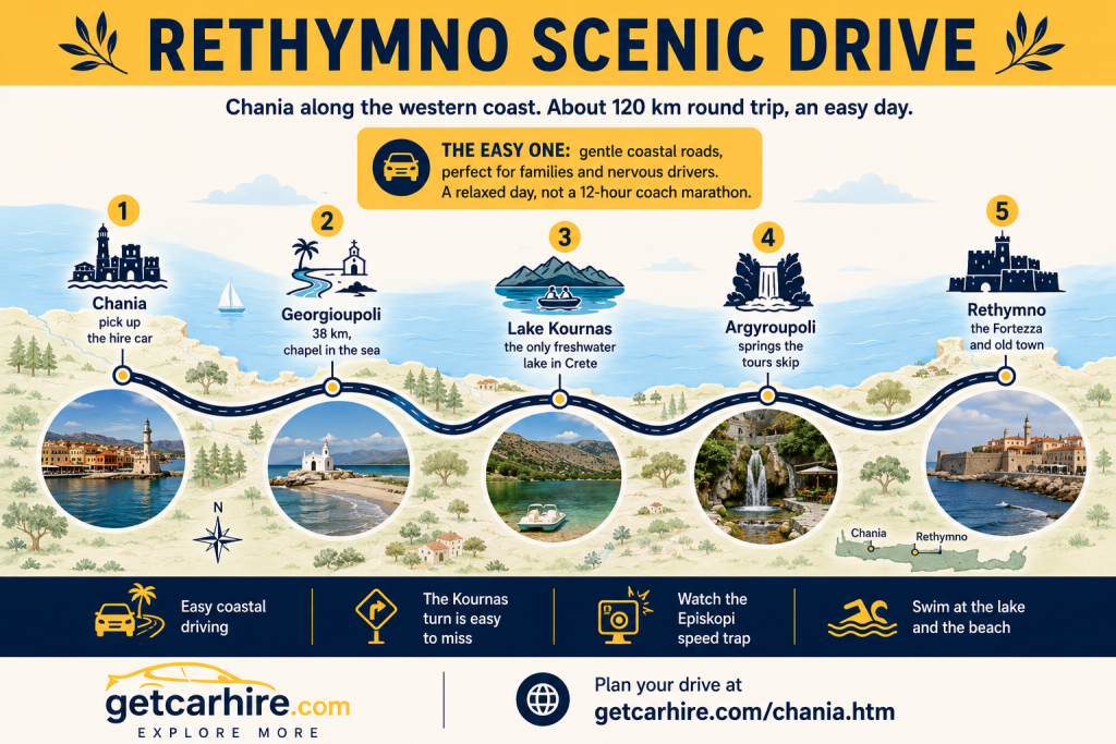
Illustrated route map infographic titled "The Pointe du Raz Scenic Drive" showing a scenic driving route across Cap Sizun in western Brittany from Audierne to Pointe du Raz, Baie des Trépassés, Pointe du Van and Pont-Croix. Includes verified driving distances and times, practical travel advice, parking information, nearby Brest Airport, and a 40-mile coastal road trip through one of France's most dramatic cliff landscapes.

Pointe du Raz Scenic Drive: The Edge of France and the Wild Cap Sizun

The Pointe du Raz scenic drive takes you to the very edge of France. Out at the Western tip of the Cap Sizun, where Brittany runs out of land, a great rocky prow rears 72 metres above the sea and the Atlantic hurls itself against the reefs of the Raz de Sein below. This is […]

Pointe du Raz Scenic Drive: The Edge of France and the Wild Cap Sizun Read More »

Illustrated route map infographic titled "The Crozon Peninsula Scenic Drive" showing a circular driving route across the Crozon Peninsula in western Brittany. The map highlights Ménez-Hom, Morgat, Cap de la Chèvre, Camaret-sur-Mer, Pointe de Pen-Hir and Pointe des Espagnols with verified driving times, practical travel tips, toll-free roads, and a scenic 55-mile self-drive route through one of Brittany's most spectacular coastal landscapes.

Crozon Peninsula Scenic Drive: Pen-Hir, Camaret and the Wild Heart of Finistère

The Crozon Peninsula scenic drive is Brittany at its wildest. Shaped like a rough cross thrust out into the Atlantic between Brest and Douarnenez, the Presqu’île de Crozon is a land of towering cliffs, offshore rock stacks, hidden coves and heather-covered headlands, nearly all of it protected within the Armorique Regional Nature Park. It is

Crozon Peninsula Scenic Drive: Pen-Hir, Camaret and the Wild Heart of Finistère Read More »

Illustrated route map infographic titled "The Pink Granite Coast Scenic Drive" showing a scenic driving route along the Côte de Granit Rose in northern Brittany from Trébeurden to Plougrescant via Trégastel, Ploumanac'h and Perros-Guirec. Features verified driving distances and times, practical travel advice, the famous rose-pink granite coastline, nearby airports at Rennes and Brest, and a 25-mile self-drive route designed for a full day of exploration.

Pink Granite Coast Scenic Drive: Ploumanac’h and the Rose-Pink Rocks of Brittany

The Pink Granite Coast scenic drive is one of the strangest and most beautiful stretches of road in Brittany, and quite possibly in France. For about 16 miles along the North coast of the Côtes d’Armor, the granite turns a warm rose pink, weathered by 300 million years of wind and sea into boulders the

Pink Granite Coast Scenic Drive: Ploumanac’h and the Rose-Pink Rocks of Brittany Read More »

Illustrated route map infographic titled "The Emerald Coast Scenic Drive" showing a scenic driving route through northern Brittany from Cancale to Dinan via Saint-Malo, Dinard, Cap Fréhel and Fort La Latte. Includes verified driving distances and times, practical travel tips, toll-free road information, the nearest airport at Rennes (RNS), and highlights a full day coastal road trip of around 65 miles.

Emerald Coast Scenic Drive: Explore Saint-Malo, Cap Fréhel and Dinan

The Emerald Coast scenic drive is the finest day behind the wheel in Northern Brittany, and it earns its name the moment the sea comes into view. Somewhere between Cancale and Cap Frehel the water turns a shade of green you will not quite believe, shifting from jade to turquoise as the tide runs, and

Emerald Coast Scenic Drive: Explore Saint-Malo, Cap Fréhel and Dinan Read More »

Driving in the Algarve: The Easy Toll-Free, Stress-Free Guide for Relaxed Driving

The best news about driving in the Algarve arrives before you have even left the airport car park: as of January 2025 the region’s main motorway, the A22 Via do Infante, is completely toll free. That single change has quietly made driving in the Algarve easier and cheaper than it has been in over a

Driving in the Algarve: The Easy Toll-Free, Stress-Free Guide for Relaxed Driving Read More »

Nordeste Scenic Drive: The Wild East of Sao Miguel

The Nordeste scenic drive takes you to the wild, green far East of São Miguel, the oldest, least developed and most flower-filled corner of the island, where waterfalls tumble through fern valleys, manicured clifftop viewpoints hang over the Atlantic, and the roads are blissfully quiet. This is the part of the island most day-trippers rush

Nordeste Scenic Drive: The Wild East of Sao Miguel Read More »

North Coast Sao Miguel Scenic Drive: Tea, Springs & Ribeira Grande

The North Coast Sao Miguel scenic drive is the island’s gentlest great day out: a run along the rugged northern shore taking in Europe’s oldest tea plantations, a thermal waterfall in a jungle of ferns, clifftop viewpoints over the Atlantic, and the handsome old surf town of Ribeira Grande. Where Sete Cidades and Lagoa do

North Coast Sao Miguel Scenic Drive: Tea, Springs & Ribeira Grande Read More »

Lagoa do Fogo Scenic Drive: Discover São Miguel’s wildest crater lake

The Lagoa do Fogo scenic drive takes you to the wild heart of São Miguel: a crater lake of turquoise and deep blue, ringed by 300-metre green walls, sitting alone in the centre of the island with no village, no cafe and no road around it, just the view. Rated the island’s top natural attraction,

Lagoa do Fogo Scenic Drive: Discover São Miguel’s wildest crater lake Read More »

Scroll to Top